

Since its foundation by Alexander the Great in 332 BC, and for almost a thousand years, the city of Alexandria has witnessed continuous growth and prosperity. Within a few decades of its establishment, it became a major commercial center of the ancient Mediterranean world, and for more than three hundred years, it remained the richest and most populous city.
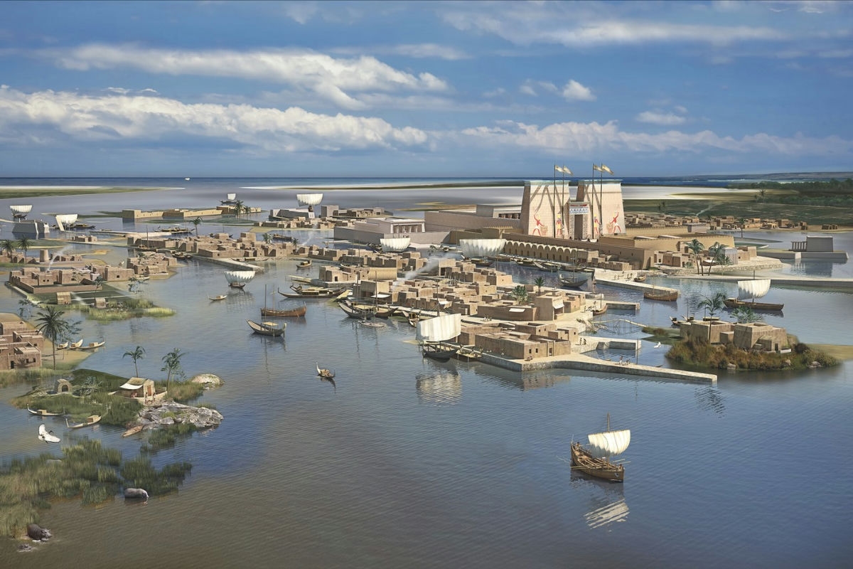
The city’s establishment was based primarily on its location on the coast and its connection with Pharos Island opposite to it, this led to the formation of two natural ports at the beginning, one in the west and the other in the east, which was the most important at that time.
The foundation of Alexandria has been affected by two natural processes: sedimentation and geological subsidence. These two factors have led to large-scale of changes in the local topography, causing the loss of many of the city’s ancient landmarks. Excavations have also shown that the current ground level of the city is several meters higher than it was previously.
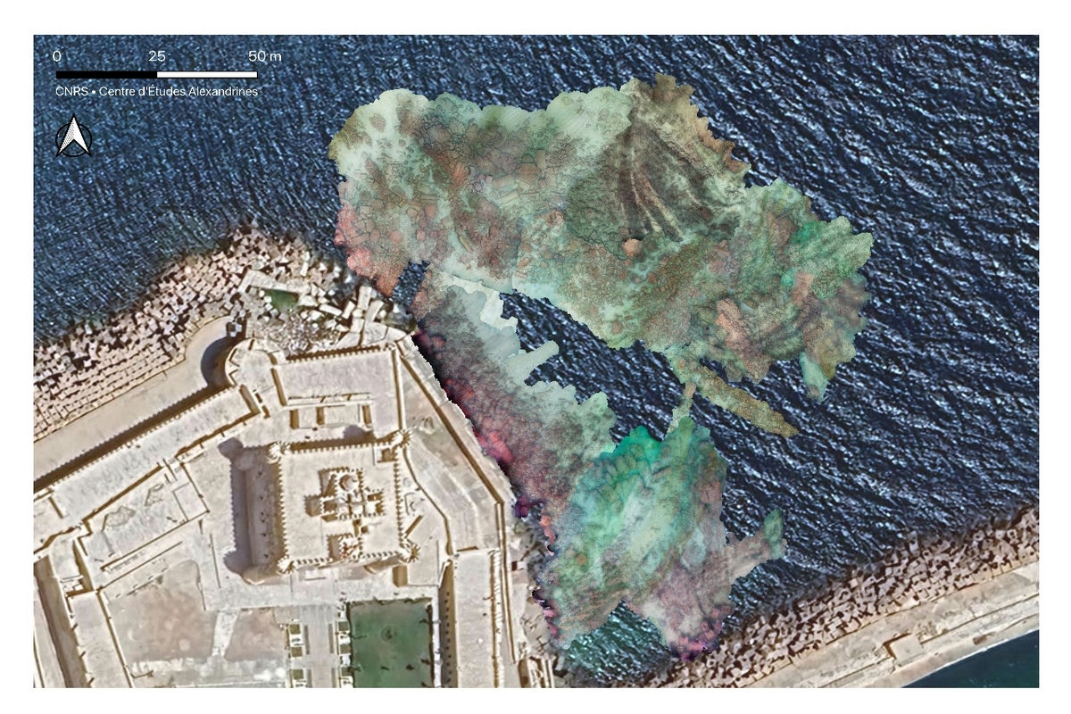
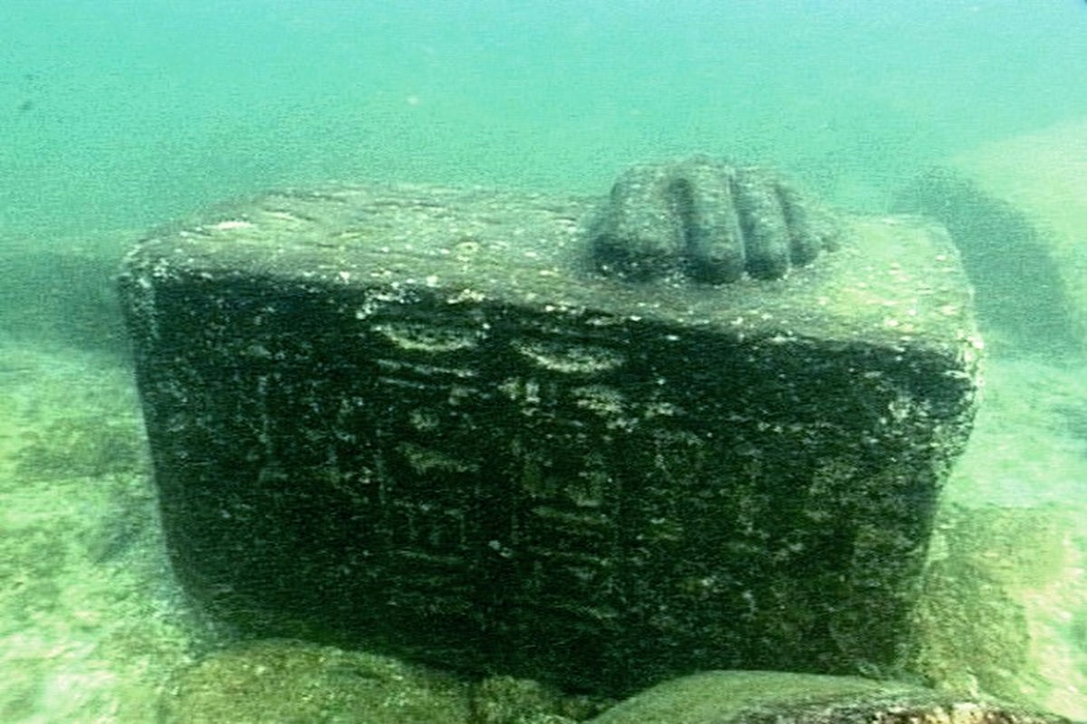
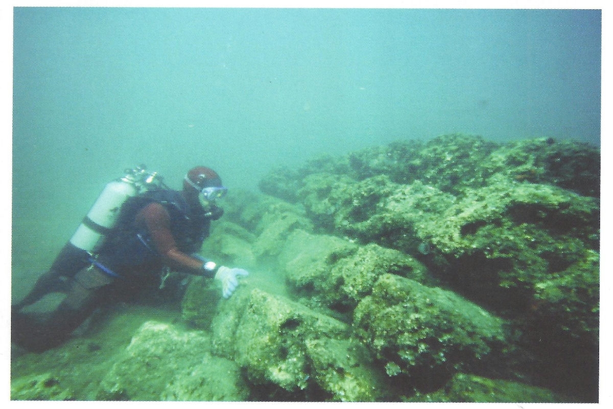
Archaeologists need to dig six or seven meters deep in order to reach the remains of the Roman era, They may reach a depth of twelve to fourteen meters in some areas to find the Ptolemaic layers. This depth is usually below the water level. The island of Antirhodos can be seen on a clear day under the waters of the eastern harbor.There were several columns standing under the waters of the eastern harbor that could be clearly seen on clear days. And they formed an obstacle that prevent ships from reaching the shore where the obelisks stand, while we know that in the Roman era ships could sail directly to the shore.
All these considerations led specialists to believe that the most important remains and sites of ancient Alexandria are still submerged under the sea. And that what appeared in it, is only a small sample of the archaeological wealth hidden under these waters.
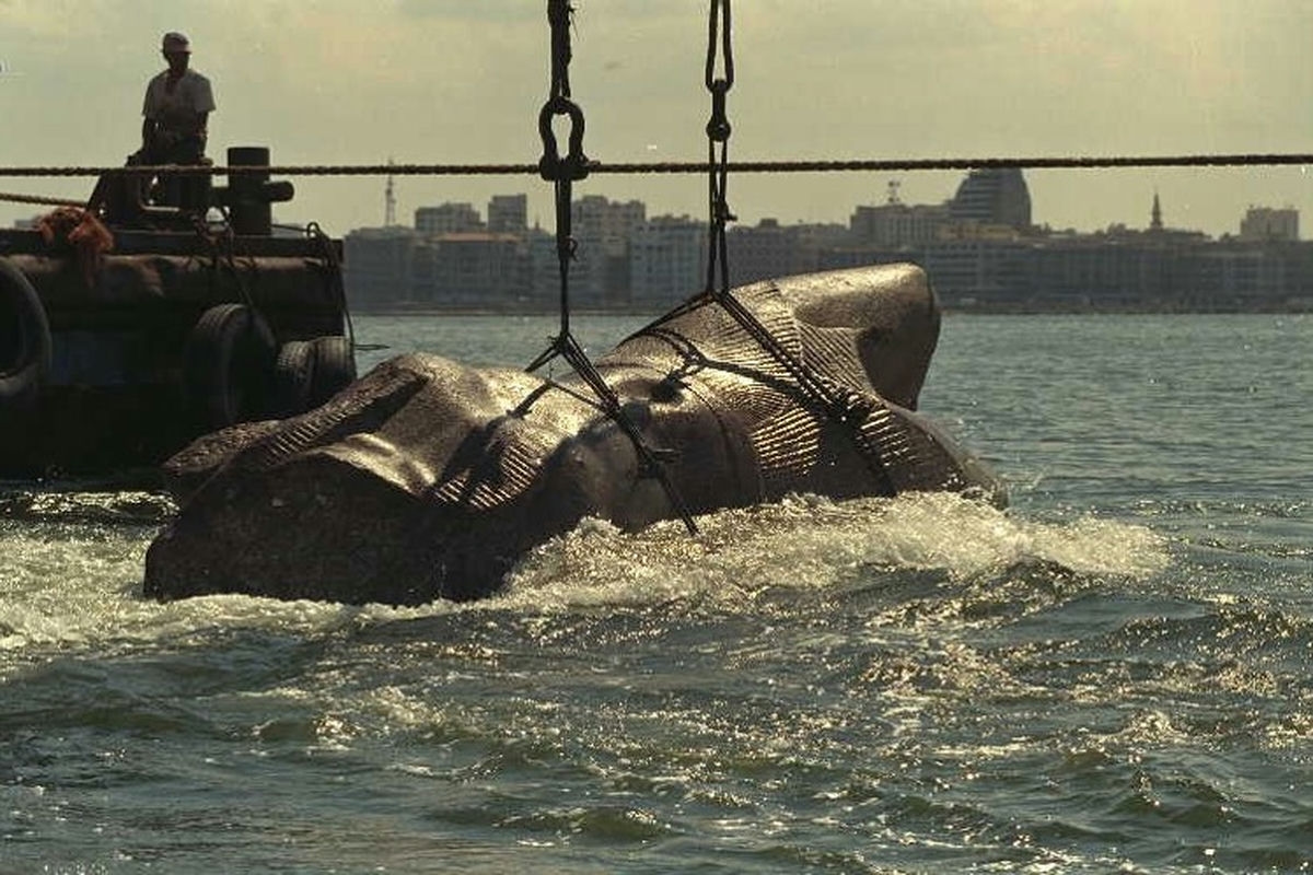
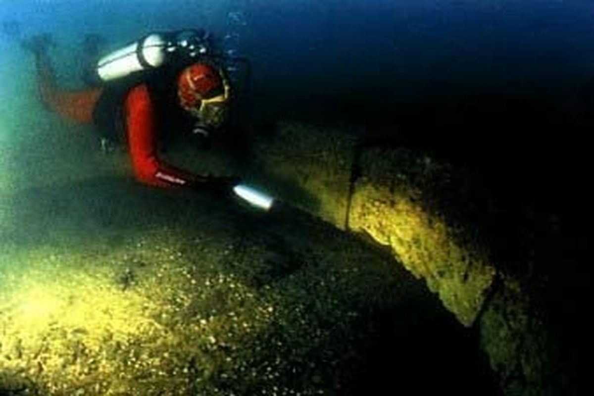
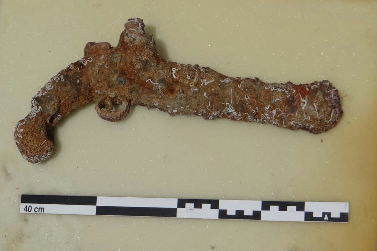
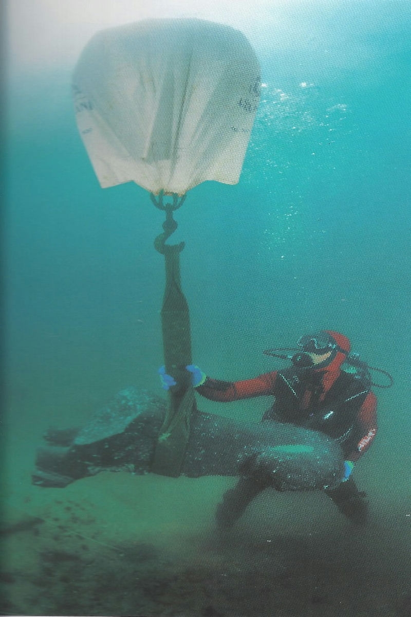
Underwater excavations that began in Alexandria in 1908 led to the discovery of many sites in Dekheila and in the north of Pharos Island in what is known as the Port of Gondia, the remains of the Lighthouse of Alexandria on the eastern end of the island itself, the royal district and the remains of the grand port in the eastern port. In addition to, the remains of Ras Lochias, which is sunken in its eastern part opposite the current library, the sites located off the shores of Alexandria in Shatby, Ibrahimia, Sporting, Sidi Gaber, El-Kur Island and Bir Masoud, as well as the site of El-Maamoura. Futhermore,the famous excavations in Abu Qir Bay, where the remains of the eastern district of Canopus and the city of Heracleion are located.
The first wave of archaeological excavations began individually and by chance, but with sound scientific rules, in 1908, followed by other waves in the thirties, sixties, and eighties of the last century until it developed and became organized scientific excavations in a wave that began in 1994 and is still continuing until now thanks to the formation of a department specialized in this work affiliated with the Supreme Council of Antiquities .
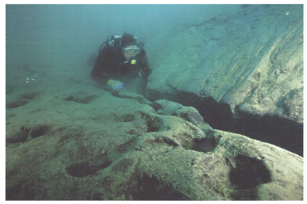
Pharos Port, that submerged rocky chain that extends north and west of Pharos Island. The reasons for the sinking ,according to the geological and geomorphological research and studies conducted by geologists in those sites, indicate the existence of the phenomenon of continuous subsidence of the land and the continuous rise of the sea level in Alexandria, in addition to the sudden subsidence of the land due to the tsunami in year 365 and the earthquake of the eighth century AD. The total subsidence is estimated at about 5 meters or a little more, and the sea level has risen by more than 3 meters, achieving a difference from the old ground level of about 8 meters, which led to the submergence of parts of the city, especially its seafront.